How do Archaeologists Locate Sites?
I get this question a lot: “How do archaeologists know where to dig?” The answer is that there are many ways to find archaeological sites. These include talking to locals, learning what to look for through experience, employing modern technology, and walking surveys. I will briefly describe what each of those methods entail, to give you a better idea of how archaeologists locate sites.
Local Information and Experience
The people who live in or frequent an area may already know where to look for archaeological sites. For instance, this past summer I volunteered on a dig in northern Ohio where the landowners had been finding artifacts since the 1920s – decades before the first archaeological digs.
Thus, speaking with locals can be one way to pinpoint sites. In the United States and Canada, there are many avocational (non-professional) archaeological societies comprised of people who are experts on their region’s past, and these can be excellent groups to consult with.
Experienced archaeologists can also be surprisingly good at spotting landscape features that might indicate the presence of sites.
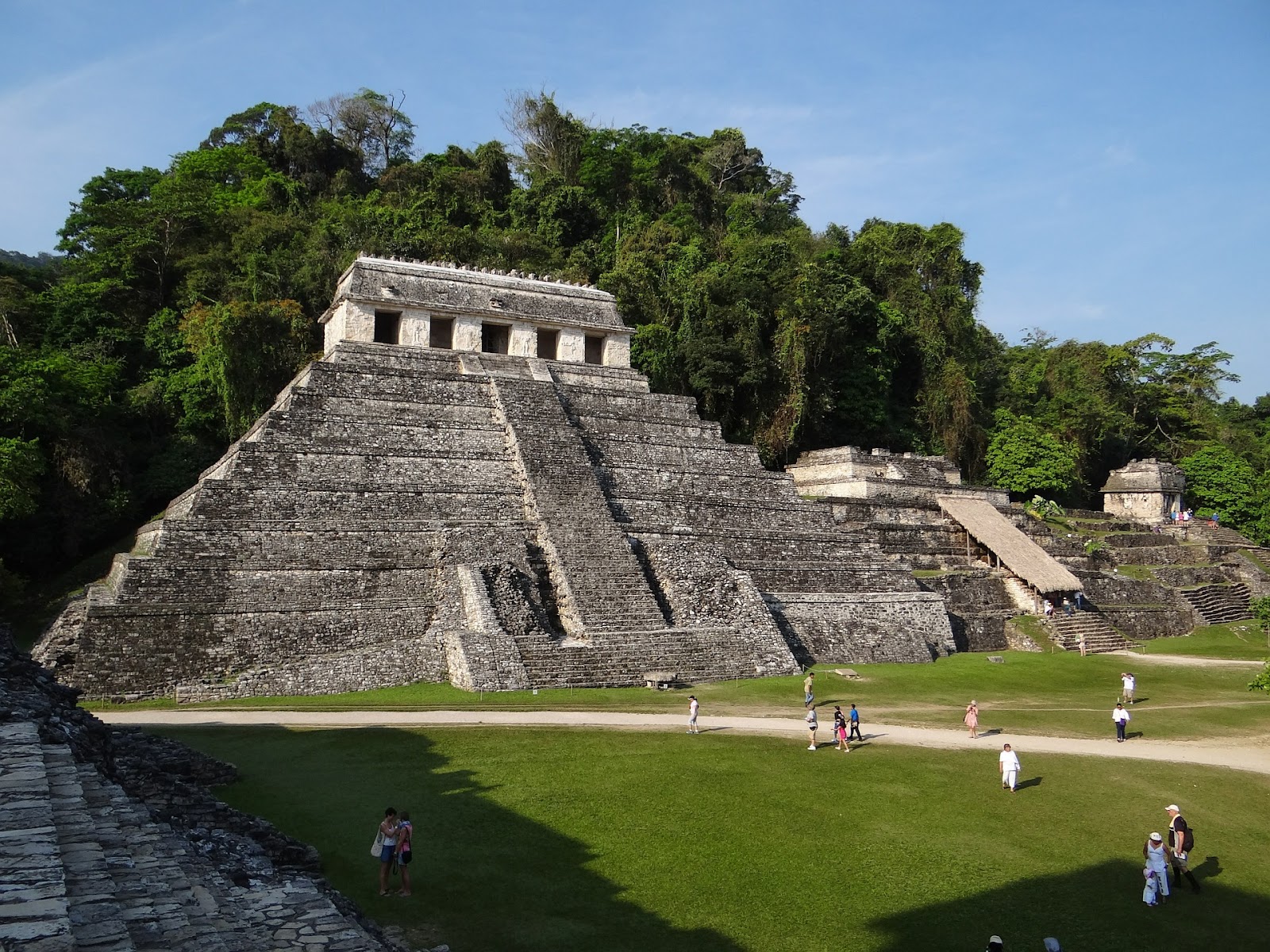
I got a taste of this during my archaeology field school in Belize. While hiking through the jungle, we would often pass low hills or mounds that looked natural to me, but which the more advanced group members instantly recognized as buried Mayan structures.
Technology
Technology is revolutionizing archaeology. Techniques like aerial and satellite photography, along with Light Detection and Ranging (LiDAR), allow archaeologists to locate sites from above.
Aerial photography can be especially useful over cropland. Buried features can change the richness of the soil above them, causing the plants in their vicinity to grow more robustly or sparsely than the surrounding vegetation. This forms patterns – or crop-marks – that are visible from the air.
In addition, satellites can spot features that are hard to notice at ground level. This was the case in 1992, when a satellite detected ancient footpaths in the deserts of Oman. By tracing these footpaths to the location where they converged, archaeologists re-discovered the lost city of Ubar.
LiDAR goes a step further than standard aerial photography. It works by emitting lasers, which, when mounted to an overhead aircraft, bounce off the ground and back to a receiver on the aircraft. LiDAR devices measure how long it takes the lasers to return, and this data can be used to generate detailed models of the terrain.
In other words, LiDAR allows archaeologists to see through dense vegetation, thereby revealing the locations of sites that might otherwise take years to find.
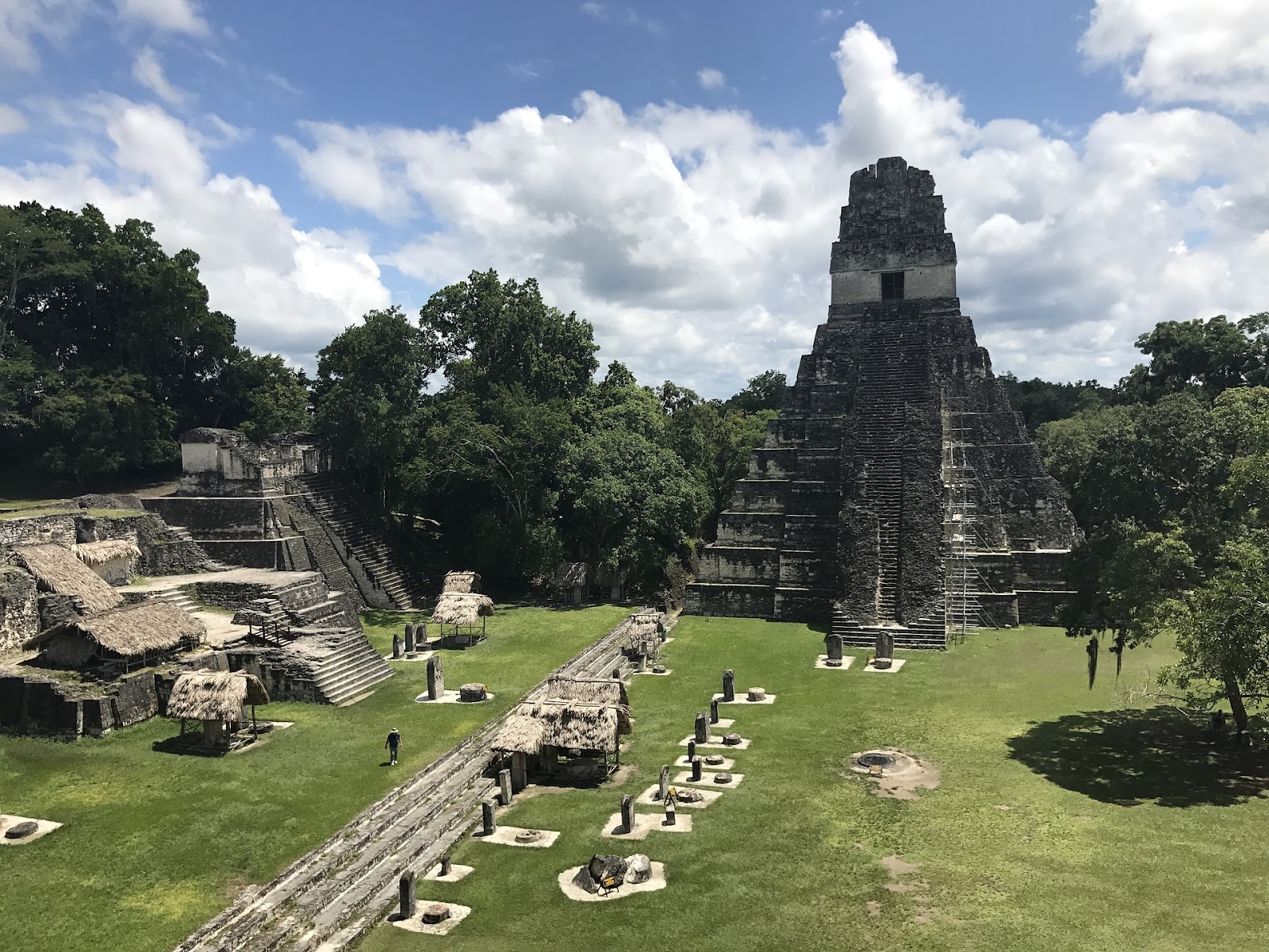
In 2018, LiDAR scans revealed that the Mayan city of Tikal in Guatemala is substantially larger than previously realized. Seen here is Temple I and part of the Main Plaza at Tikal. Image by ickandgak from Pixabay.
I was able to witness the benefits of LiDAR firsthand while in Belize. The team I was working with had recently conducted LiDAR scans of the area surrounding their sites, and they learned that many more structures lay deeper in the jungle. Our most experienced team members immediately organized an expedition to those structures, during which they had many, jaguar-filled adventures.
There are also several ground-based technologies that can detect buried objects. These include magnetic and electromagnetic sensing devices, various types of probes, machines that measure electric resistivity (the ease or difficulty with which an electric current moves through a substance), and ground-penetrating radar (GPR).
The above technologies, both airborne and ground-based, can be extremely useful for detecting hidden features and artifacts, but they all have limitations.
For example, GPR devices project radar waves into the earth, which then reflect off the objects they hit and are measured by a receiver on the GPR machine – forming three-dimensional images of the underground environment. However, wet and clayey soils absorb radar waves, limiting GPR’s effectiveness on such terrain.
Due to these limitations, along with time and funding constraints, walking surveys will never go out of style.
Walking Surveys
Walking surveys are tried-and-true methods to find archaeological sites.
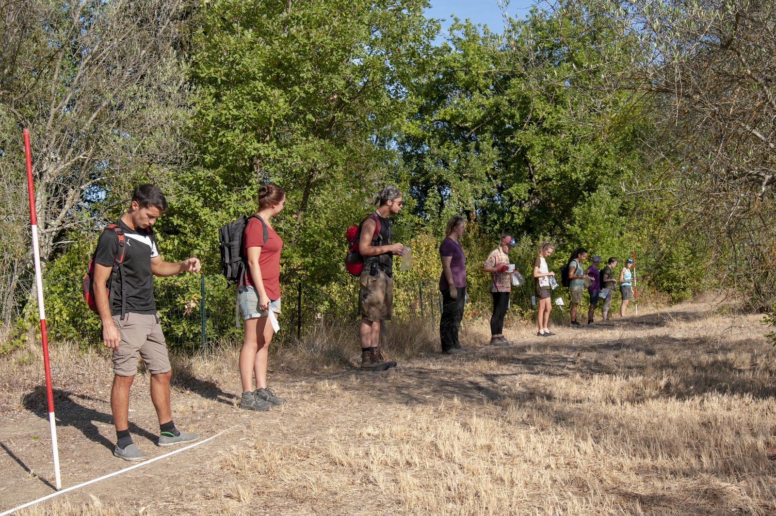
Walking surveys can be unsystematic or systematic. In the former scenario, teams of surveyors simply walk around and look for artifacts on the surface of the ground. Systematic surveys are more complicated than their unsystematic brethren, but they are also less biased.
One way to conduct a systematic survey is through transects: pre-determined, straight lines in which team members walk – no matter what – while recording each artifact that they find. This is a good way to determine where the most promising locations are to excavate, but many study areas are too large to be covered entirely by transects. Thus, another option is to use a variety of sampling techniques to divide the landscape into squares, which can then be surveyed.
What to Remember About Archeology Surveys
In summary, there are many ways that archaeologists locate sites. Talking to locals is often a good place to start, as they may already know where people have been finding artifacts or features. Experience also makes it easier to identify good places to dig, as do a host of technological devices.
Modern technology is becoming increasingly valuable for archaeology. Airborne devices like LiDAR are proving indispensable for finding new sites, or in expanding our knowledge of existing ones. Ground-based remote-sensing technologies keep improving as well, and can greatly assist the surveying process.
Finally, teams of trained surveyors – either walking in transects or working in sample squares – will always be an indispensable part of archaeology.
Sources:
Ford, A., & Horn, S. (2014). Above and below the Maya forest. Science, 361(6409).
Herbich, T. (2012). Geophysical methods and landscape archaeology. Egyptian Archaeology.
McMillon, B. (1991). The archaeology handbook: A field manual and resource guide. New York, NY: John Wiley & Sons, Inc.
Kline, Eric. (2017). Three stones make a wall: The story of archaeology. Princeton, New Jersey: Princeton University Press.
Pîrnău, R. G., Mihu-Pintilie, A., Bodi, G., Asăndulesei, A., & Niacşu, L. (2014). Ground-penetrating radar as noninvasive method used in soil science and archaeology. Soil Forming Factors and Processes from the Temperate Zone, 13, 15-31.
Redmond, B. G., & Scanlan, B. L. (2010). A report of archaeological investigations at the Heckleman Site (33Er14): 2009 season. Cleveland Museum of Natural History Archaeological Research Reports, No. 158.
Renfrew, C., & Bahn, P. (2015). Archaeology essentials (3rd Ed.). London: Thames & Hudson.
Smekalova, T. N., Yatsishina, E. B., Garipov, A. S., Pasumanskii, A. E., Ketsko, R. S., & Chudin, A. V. (2016). Natural science methods in field archaeology, with the case study of Crimea. Crystallography Reports, 61(4).